Tickets & prices
Free to visit. Accessible 24/7.
Parking available in Kobarid centre (free) or at Kamp Koren just past the bridge (€1.50/hour).
Napoleonov most
An 18th-century stone bridge over the Soča gorge – starting point for Kobarid's waterfall trails
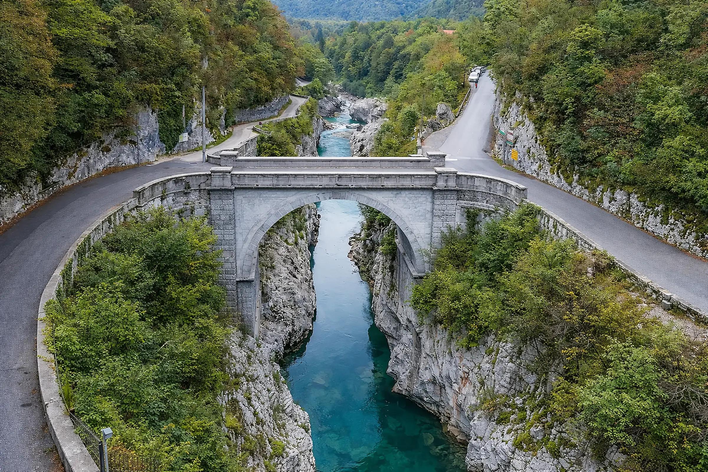
Napoleon Bridge (Napoleonov most) is a stone arch bridge over the Soča River at the narrowest point of its gorge, 1 km from the centre of Kobarid. Built in 1750, it was named after Napoleon's troops who crossed it in 1797 en route to Predel Pass.
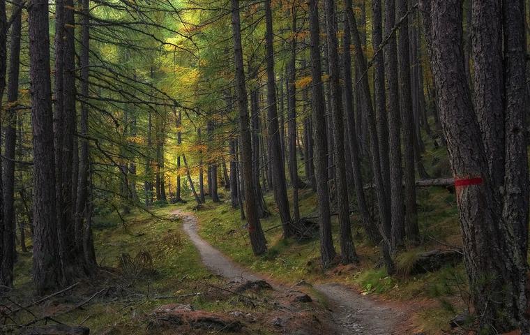
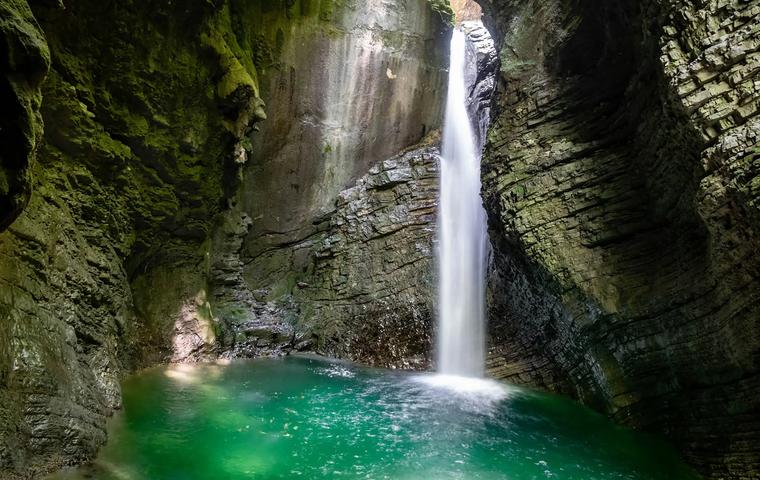
The bridge is the starting point for two popular routes: the trail to Kozjak Waterfall (30 minutes) and the Kobarid Historical Trail. From the bridge, you look down at the turquoise Soča flowing through a rocky canyon 15–20 m below.
Free to visit, accessible 24/7. The bridge itself takes 5–10 minutes, but it makes sense to combine it with the walk to the waterfall.
The bridge is a single-arch stone structure spanning the narrowest section of the Soča riverbed. Low stone parapets line both sides. It's about 20 m long and wide enough for one car – the bridge serves as a road to Drežnica village and nearby campsites. Traffic alternates – you'll need to yield to oncoming vehicles.
Looking down from the bridge, the Soča is squeezed between rock walls. The water colour ranges from deep emerald to turquoise, depending on light and season. In summer, kayakers can be spotted navigating the gorge below. Two WWII memorials stand by the bridge, commemorating the Partisans who defended the Kobarid Republic in 1943.
On the right bank, just past the bridge, a turn leads to the car park and the Kozjak Waterfall trail. Straight ahead is the road to Drežnica. About 500 m downstream, another access point leads down to the water.
Age – built in 1750, the crossing point has been used since antiquity
Name – Napoleon's troops marched across in 1797 en route to Predel Pass
Soča River – views from the bridge into a turquoise canyon 15–20 m deep
Starting point – trails to Kozjak Waterfall and the Kobarid Historical Trail begin here
Military history – blown up in WWI (by Austrian troops), defended in WWII (by Partisans)
A crossing at this point has existed since antiquity – the Soča gorge is at its narrowest here. In the Middle Ages, the bridge belonged to the Čedad monastery. In 1616, Venetians demolished the wooden bridge. A single-span stone bridge was built in 1750. In 1797, Napoleon's forces crossed it en route to Predel Pass, giving the bridge its name.
During World War I (Isonzo Front), Austrian soldiers blew up the bridge while retreating in May 1915. The Italians rebuilt it – first in wood, then in iron. The current stone bridge is a postwar reconstruction. In World War II, Partisans defended the Kobarid Republic here. On 9 November 1943, SS soldiers killed Partisan Ivan Berginc near the bridge. Two memorials beside the bridge commemorate these events.
Free to visit. Accessible 24/7.
Parking available in Kobarid centre (free) or at Kamp Koren just past the bridge (€1.50/hour).
The bridge is an active road. Pedestrians must yield to cars – there's no pavement and width is limited. Photography unrestricted. Don't lean over the parapet – the drop to the water is 15–20 m.
On site: memorials and an information plaque. Cafés, shops, and toilets are in Kobarid centre (1 km).
Parking: no stopping on the bridge. Nearest: Kamp Koren (50 m past the bridge, €1.50/hour) or free in Kobarid centre.
Accessibility: the bridge is accessible for wheelchairs and people with limited mobility (flat surface, no steps).
From Kobarid centre (1 km, 15 minutes on foot):
- Walk toward Drežnica – the bridge is on the road out of town
- By car – 2 minutes
From Ljubljana (135 km, 2–2.5 hours):
- By car via Tolmin, then road 203 to Kobarid
- Bus to Kobarid (~3 hours, ~€12), then 15-minute walk from the bus station
From Bovec (20 km, 20 minutes):
- Along road 203 following the Soča River
Season: Accessible year-round. The Soča is most turquoise from May to October.
Time of day: Morning and evening offer the best light for photographing the bridge and canyon. At midday, the sun sits high and the canyon is in shadow.
Duration: 5–10 minutes for the bridge itself. Best combined with the Kozjak Waterfall trail (add 1–1.5 hours).
Avoid: No major restrictions. In summer, traffic across the bridge can be busy – stay alert as a pedestrian.
Practical answers about visiting, routes and time on site.
No, it's free. The bridge is part of a public road, accessible 24/7.
No stopping on the bridge itself. Nearest parking: Kamp Koren, 50 m past the bridge (€1.50/hour). Or park for free in Kobarid centre and walk 15 minutes.
Access to the water at the bridge is difficult due to steep rock walls. About 500 m downstream, there are gentler banks where locals swim. The water is cold – 8–12 °C in summer.
The bridge carries car traffic and has no pavement. Pedestrians need to press against the parapet when cars pass. It's narrow but manageable.
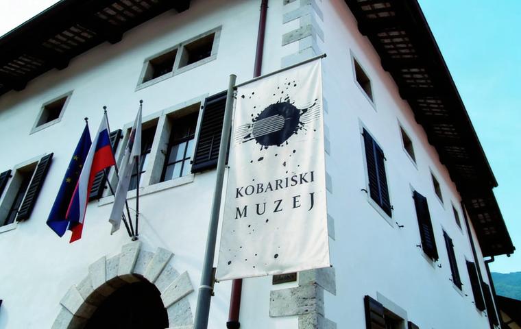
The trail to Kozjak Waterfall starts right past the bridge (30 min). In Kobarid: the WWI museum and Italian Charnel House. A 20-minute drive away: Virje Waterfall near Bovec.
5–10 minutes for the bridge and photos. But it's best combined with the walk to Kozjak Waterfall – the trail begins right past the bridge.
Bus from Ljubljana to Kobarid (Arriva/Nomago, ~3 hours, ~€12). From Kobarid bus station, it's a 15-minute walk to the bridge.
Yes, the bridge surface is flat with no steps. The road from Kobarid centre to the bridge is paved.