Hero background

Mtirala National Park

მტირალას ეროვნული პარკი

A subtropical rainforest 25 km from Batumi – the wettest place in Georgia

Mtirala National Park is a 15,700-hectare protected area in the southwestern Caucasus mountains of Adjara. The name "Mtirala" means "crying" in Georgian – constant fog and high humidity cause water to drip from the trees, creating the sensation of perpetual rain. The highest point is Mount Mtirala at 1,381 m.

The park is 25 km from Batumi. The visitor center is in Chakvistavi village. Get there by taxi from Batumi for 80–100 GEL (~$30–37) or take a bus to Chakvi (1.5 GEL), then a taxi to the visitor center (20–30 GEL). A direct minibus runs only on Mondays and Fridays.

Entrance is free. Allow 3–4 hours for the main trail (Tsablnari, 7 km). The park is ideal for hiking and nature – there's a waterfall, a lake, a zipline, and a rope park.

Location

On the Map

About

What's Here

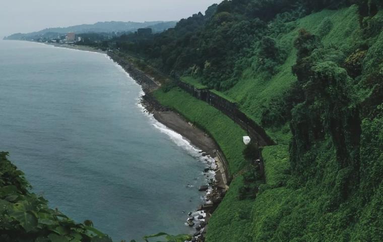
Mtirala is a Colchic subtropical forest preserving ancient vegetation: sweet chestnuts, oriental beech, cherry laurel, boxwood, and numerous species of lianas and ferns. The air is humid and thick – temperatures under the forest canopy run 5–7°C lower than on the coast. The trail begins at the visitor center, where a mechanical cable cabin (2 GEL) carries hikers across the Chakvistskali River. On the far side, the circular Tsablnari trail (7 km) begins.

About 1.5 km from the entrance, you'll reach the zipline (220 m, 15 GEL) over the treetops and the rope park (15–20 GEL). The trail then forks: right leads to the 15-meter Tsablnari Waterfall (another 1.5 km uphill), left goes to Mtirala Lake. The waterfall is framed by boxwood and ivy, with a small rock pool at its base. The lake is a peaceful forest pool where swimming is welcome. Both directions loop back to the river crossing.

The second trail – Tsivtskaro (16 km, 2 days) – is for experienced hikers. It climbs through beech groves to 1,250 m altitude, where a shelter accommodating 8 people is located. Tracks of brown bears, roe deer, and martens are common along this route. A ranger is recommended.

Why Visit

The Highlights

Rainfall – the wettest place in Georgia, up to 4,500 mm of annual precipitation, constant fog and dripping canopy

Ancient forest – Colchic subtropical ecosystem with sweet chestnuts, beech, boxwood, cherry laurel, and endemic fern species

Tsablnari Waterfall – 15 meters, surrounded by Colchic boxwood and ivy, reachable in 30–40 minutes on the trail

Zipline – 220 m over the subtropical forest canopy, 15 GEL (~$5.50)

Wildlife – brown bears, lynx, roe deer, Caucasian salamander, approximately 80 bird species

History

Past & Present

The area around Mount Mtirala has been inhabited since the early medieval period – ruins of fortresses and bridges survive in the surroundings. In the 13th century, the Skhalta Church was built nearby in the hall-type architectural style and still stands today. Traditional wooden houses in surrounding villages are 100–200 years old and represent examples of Adjarian folk architecture.

The national park was established in 2006–2007 on the initiative of Georgia's Ministry of Environmental Protection, with support from WWF and the Norwegian government. Its purpose is to preserve Colchic ecosystems and rare species of flora and fauna, many listed in Georgia's Red Book. Today, the park is part of Georgia's protected areas system and actively develops ecotourism.

For Visitors

Visitor Information

Tickets & Prices

Park entrance: free

Paid activities:

Cable cabin river crossing: 2 GEL (~$0.75)

Zipline (220 m): 15 GEL (~$5.50)

Rope park (family zone): 15 GEL (~$5.50)

Rope park (adult zone): 20 GEL (~$7.40)

Picknick area rental: 10–15 GEL

Horseback ride: 50 GEL (~$18.50)

Payment on-site at the visitor center.

Rules & Restrictions

Non-slip footwear is essential – the trail is rocky, steep in places, and slippery after rain. Bring a rain jacket – precipitation is possible at any time. Pack swimwear for the lake. Carry all trash out – there are no bins on the trails. Restricted zones and excavation areas are fenced off. For the Tsivtskaro trail (16 km, 2 days), a ranger is recommended.

On-Site Facilities

At the visitor center:

Exhibition hall with park information

Toilets (free)

Shower (small fee)

English-language brochures

On the trails:

Designated picnic areas with fire pits

Tourist shelter at km 9 (Tsivtskaro trail, 8 spots, bring a sleeping bag)

At the entrance:

Mtirala restaurant (Georgian cuisine, average check 25–35 GEL / $9–13)

Several guesthouses

Parking: Free lot at the entrance.

Connectivity: Mobile signal is weak or absent on the trails. No internet.

Accessibility: Trails are not adapted for visitors with limited mobility – steep ascents, uneven paths, river crossing.

Getting There

Transport & Directions

From Batumi (25 km to the visitor center):

– Direct taxi: 80–100 GEL (~$30–37), 40–50 minutes. With 3-hour wait and return – 120–150 GEL

– Minibus to Chakvi (from near the Catholic Church, 54 Gogebashvili St): 1–1.5 GEL, then taxi from Chakvi to the visitor center: 20–30 GEL

– Bus #6 or route #40 to Chakvi: 1.5 GEL

– Direct minibus Batumi–Chakvistavi: Mondays and Fridays only, 3 GEL, departing 08:00 / 17:50 from Batumi bus station

Organized tour – from 100–150 GEL with transport

On site:

From parking to visitor center – 5-minute walk. From visitor center to trailhead – cable cabin river crossing (2 GEL).

When to go

Best time to visit

Season: May–October – trails are open and safe. Driest months are June and September. In winter, trails are closed due to wet and slippery conditions.

Time of day: Arrive by 9:00–10:00 to complete the trail before group tours arrive (usually after 12:00).

Duration: 3–4 hours for the Tsablnari loop (7 km) with swimming. Full day with zipline and lunch.

Avoid: Rainy days – the trail becomes slippery and muddy. July–August brings intense humidity and heat – carry plenty of water.

FAQ

Common Questions

Entrance is free. Paid activities: zipline – 15 GEL (~$5.50), rope park – 15–20 GEL, cable river crossing – 2 GEL.

Easiest option: taxi from Batumi – 80–100 GEL (~$30–37) with a wait. Budget option: bus to Chakvi (1.5 GEL), then taxi to the visitor center (20–30 GEL). A direct minibus runs only on Mondays and Fridays.

The Tsablnari loop trail (7 km) with waterfall and lake takes 3–4 hours. With zipline, swimming, and lunch – 5–6 hours.

Yes. Swimming is allowed in Mtirala Lake – the water is cool but refreshing. The pool at the waterfall base is shallow and not suitable for full swimming.

The Tsablnari trail is moderate difficulty. Fine for children aged 7–8+ with proper footwear. There are steep sections and slippery rocks. Challenging for small children and elderly visitors.

Hiking shoes with non-slip soles, rain jacket, water (1–2 liters), swimsuit, trash bag. In summer – insect repellent.

Mtirala restaurant near the park entrance serves kebabs and salads, average check 25–35 GEL (~$9–13). Guesthouses in Chakvistavi offer home-cooked meals.

Weak 4G signal near the visitor center. On the trails – virtually no connectivity. Download trail maps offline before visiting. eSIM works, but not on the trail.

Distance

Travel Time

From Batumi by taxi or transfer ~25 min.
From Kutaisi by car ~2 h 25 min.
From Bakuriani by car ~3 h 29 min.
From BUS airport (Batumi Airport (BUS) – Gateway to the Black Sea Coast) by car ~30 min.
From KUT airport (Kutaisi Airport (KUT)) by car ~1 h 56 min.
Social

Share